Weather alerts have been issued for five northern New Jersey counties due to freezing rain that forecasters say could cause a dangerous coating of ice tonight into early Monday.
The National Weather Service’s winter weather advisories run from 4 p.m. to midnight in Passaic and western Bergen counties and 6 p.m. to 2 a.m. in Morris, Sussex and Warren counties.
“From 1/10 to 1/4 inch of ice will result in hazardous travel conditions in these areas,” the weather service said early Sunday. “Freezing rain will change to plain rain by daybreak Monday. For the rest of the area, precipitation will be plain rain.”
Light precipitation will overspread northern New Jersey during the mid to late afternoon hours.
As temperatures hover near or below freezing Sunday evening across northern areas, precipitation will fall as freezing rain for two to three hours before temperatures rise above freezing overnight.
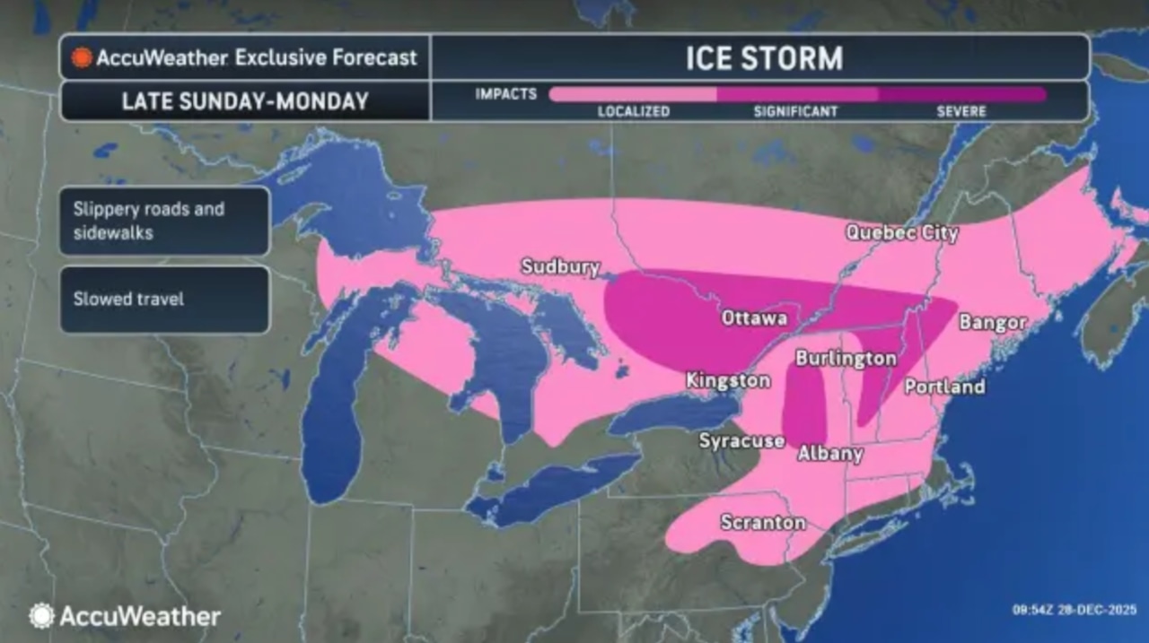
The warm front will lift through the region overnight Sunday into early Monday morning, causing temperatures to rise into the 30s and 40s.
Any remaining freezing rain will change to plain rain during the pre-dawn hours Monday.
There will likely be a brief period where most of the region is precipitation-free prior to daybreak Monday, the weather service said.
Fog is possible overnight, with some areas potentially experiencing locally dense fog depending on the progression of the warm front.
“Rain showers then affect the area on Monday as a cold front approaches from the west,” the weather service said. “Can’t rule out some gusty winds and even a rumble of thunder with passage of that cold front in the afternoon. Winds then increase Monday afternoon.”
Temperatures ahead of the front will warm into the low to mid 50s across most of New Jersey, with southern areas reaching the upper 50s.
Winds will increase to 15 to 20 mph with gusts up to 30 mph in the morning.
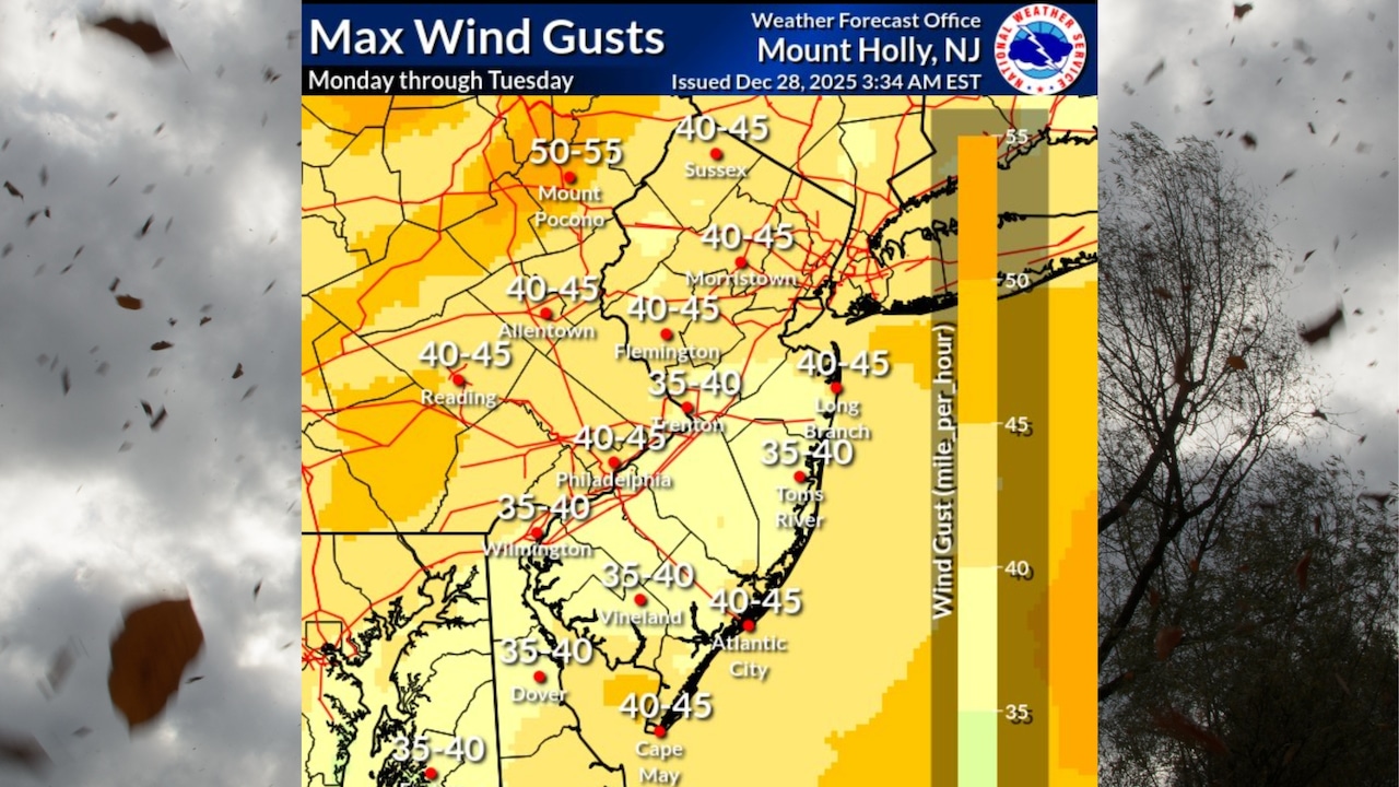
Behind the front, winds will increase significantly with gusts up to 40 mph in the afternoon. Some showers may produce wind gusts up to 50 mph.
Strong winds will continue Monday night into Tuesday, with sustained winds of 20 to 30 mph and gusts of 35 to 45 mph.
Temperatures Monday night will drop into the mid and upper 20s with wind chills in the single digits to low teens.
Tuesday will remain windy and cold, with high temperatures struggling to reach the low to mid 30s and wind chills in the teens to around 20 degrees during the afternoon.
Winds will diminish late Tuesday and Tuesday night, with lows in the 20s.
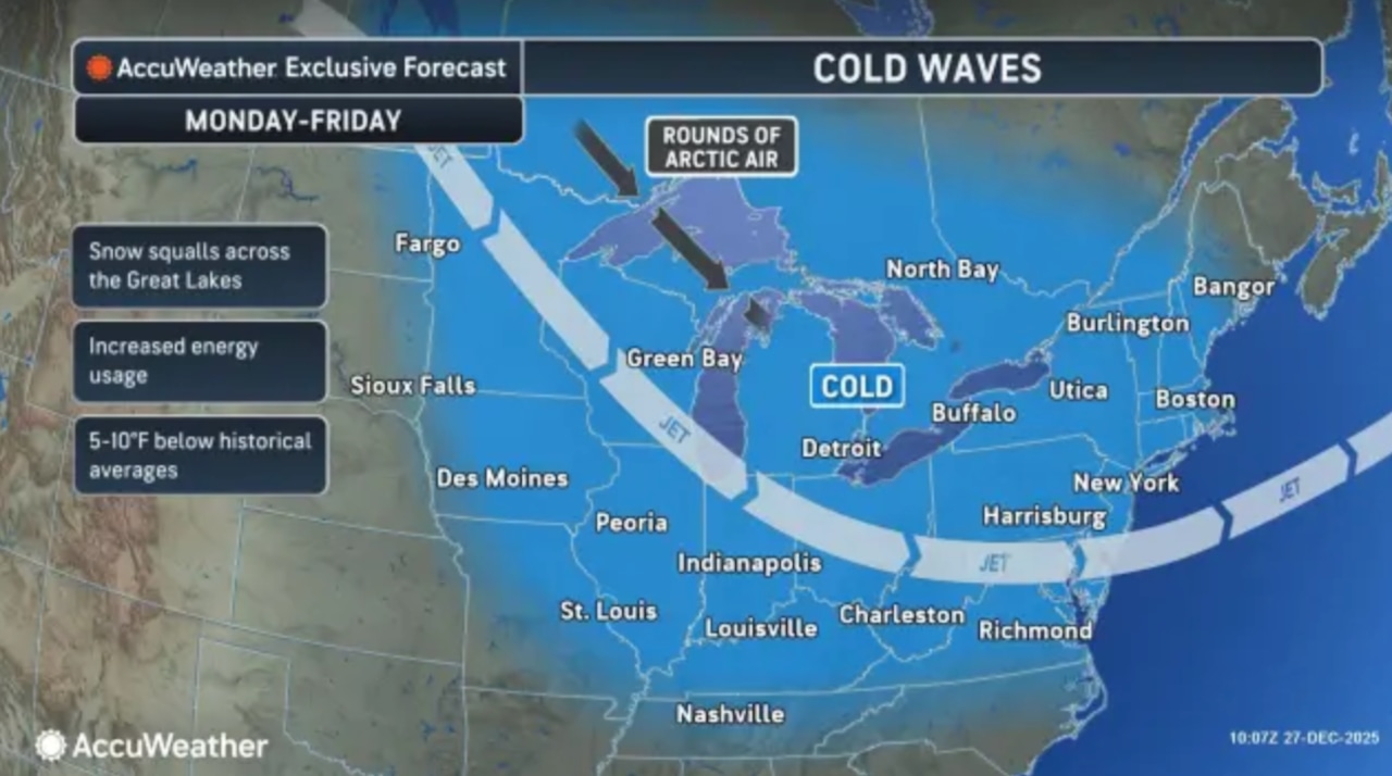
The extended forecast shows below normal temperatures continuing through the end of the week.
High pressure will briefly return Wednesday before several weak cold fronts pass through the region.
The first cold front will move through on New Year’s Eve, Wednesday night into Thursday, followed by another Friday night through Saturday.
Light snow is possible with the passage of each front, though significant widespread accumulations are not expected.
Highs will mostly be in the 30s with lows mostly in the 20s, except for Friday night when lows could drop into the teens.
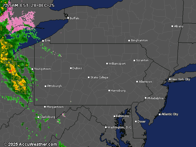
Current weather radar